
Manhattan ZIP Code Coverage by Area
Manhattan’s postal geography includes neighborhood delivery areas and many small, special, or institutional codes. The official Manhattan ZIP map is a useful overview, but NYC Health warns that small and PO-box codes may not appear. The table highlights common geographic codes alongside selected special cases. It is not a substitute for the current address result from USPS. A ZIP can be a good way to organize a search, yet it should never be used as a stand-in for a precise street address or a person’s identity.
| ZIP | Areas covered | Post office reference | Postal note |
|---|---|---|---|
| 10001 | Chelsea, Hudson Yards, Garment District, and the Penn area | Church Street Station and Empire Station are associated with 10001 | Geographic core; Farley/Penn special ZIPs also occur. |
| 10002 | Lower East Side, Chinatown, east Downtown, and Two Bridges | Knickerbocker Station | Geographic core. |
| 10003 | East Village, Union Square east, and a Gramercy edge | Cooper Station | Geographic core. |
| 10009 | East Village, Alphabet City, and Lower East Side | Peter Stuyvesant Station | Geographic core. |
| 10013 | Tribeca, SoHo, Hudson Square, and a Chinatown edge | Canal Street Station | Geographic core. |
| 10016 | Murray Hill, Kips Bay, and Midtown east | Murray Hill Station | Geographic core. |
| 10022 | Midtown East, Sutton Place, and southern Upper East Side | FDR Station | Geographic core. |
| 10023 | Upper West Side and Lincoln Square | Ansonia Station | Geographic core. |
| 10027 | Morningside Heights, West Harlem, and a Hamilton Heights edge | Manhattanville Station | Geographic core. |
| 10034 | Inwood and northern Manhattan | Inwood Station | Geographic core. |
| 10044 | Roosevelt Island | Verify a particular address through USPS | Island delivery area; facility assignment can vary. |
| 10199 | Large facility and postal operations | Morgan General Mail Facility | Not a broad neighborhood code. |
| 10280 and 10282 | Lower Manhattan and Battery Park City area | Verify a particular address through USPS | Core codes shown on the Manhattan map. |
Other Manhattan codes are more limited. The research identifies 10008 as Downtown institutional or PO-box use, 10020 as a Rockefeller Center special area, and several 101xx and 102xx codes as office, building, PO-box, or facility sections. The ZIP code directory therefore works best as a geography index. USPS must decide the mailing ZIP for one address.
Manhattan Postal Office Cross-Checks
The USPS Postmaster Finder is helpful for a historical ZIP-to-post-office cross-check, but it does not promise that a named office currently serves every address. Use the live USPS ZIP Lookup for a delivery address. USPS materials name James A. Farley Post Office at 421 Eighth Avenue as 10199, while a 2026 release uses 10001-9998 for the same facility. That is exactly the kind of special assignment a broad map cannot settle.
The Postmaster Finder source shown below is a useful reference for cross-checking a ZIP with an office label.
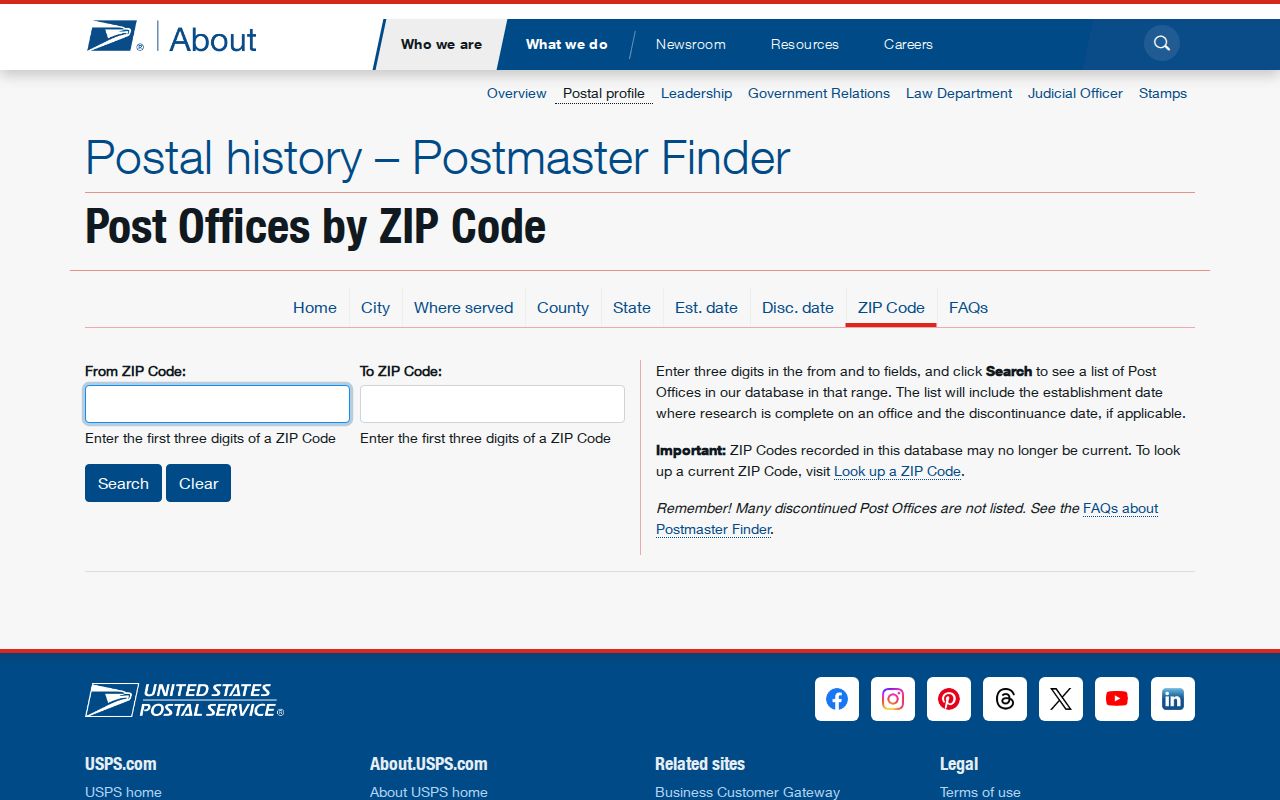
For current delivery assignment, the ZIP Lookup result controls over a historic office listing or a neighborhood nickname.
USPS’s Manhattan service material also ties Village Station to 10014, Lenox Hill to 10021, Planetarium to 10024, Cathedral to 10025, Hamilton Grange to 10031, Audubon to 10032, Washington Bridge to 10033, and Fort George to 10040. Those names are useful labels, not proof of a delivery route or a person at an address.
Manhattan Address Verification Fields
Use the USPS tool before comparing a mailing address with a directory, voter confirmation, or property record. The research documents two supported approaches: give a street address with city and state, or begin with a city and state. The result returns a standardized mailing address and ZIP. That is a postal normalization result, not a resident list or a property ownership finding.
| Lookup input | What to enter | What it does |
|---|---|---|
| Street address | Street address with city and state | Returns the standardized mailing address and ZIP for that location. |
| City and state | City and state when a street address is not yet available | Returns ZIP information for the city-state query. |
| Result check | Compare the standardized result with the source record | Separates a postal label from an old street spelling, building label, or neighborhood name. |
Manhattan records frequently use “New York, NY” rather than “Manhattan.” Retain the borough, cross street, and the exact standardized result when matching sources. A special ZIP may point to a building or a postal section instead of a neighborhood, so it should be checked again when the exact address changes.
Find Manhattan Residents by ZIP
A ZIP code narrows a known-person check but does not create a public roster. The NYC Board of Elections lookup is an exact-match confirmation tool for someone already known to be registered in New York City. It requires the person’s first name, last name, birth date, borough, and ZIP. The Department of Finance Property Information Portal, by contrast, searches address, BBL, borough/block, condominium, co-op, and specialty property-account identifiers. Its landing page is not a ZIP-wide browsing tool.
- Use USPS to normalize the known mailing address and record the returned ZIP.
- For a known voter, enter the exact name, birth date, Manhattan borough, and ZIP in the NYC Board of Elections confirmation search.
- For a property question, search the address or BBL in the DOF portal, then compare the situs address with the mailing and legal fields.
- For older context, use NYPL address and city directories by name or street. They are not organized as ZIP-wide rolls.
- Once the ZIP leads to a particular street, use the Manhattan street address directory for the address-keyed record trail.
New York restricts voter-registration information to an elections purpose under Election Law §3-103(5). A statewide or multidistrict voter-file request requires a written request and the mandatory purpose statement. It is not a shortcut to a general ZIP resident list. If the exact-match form returns no record, check spelling, birth date, borough, ZIP, address changes, inactivity, and confidentiality before drawing a conclusion.
Manhattan Resident Lookup Checks at NYC BOE
The NYC Registered Voter Search requires every field below. It says a record may not be found when the details do not match the voter record exactly. The output is a match or not-found response. It does not offer a browse-all function, and it does not reveal ballot choices. Treat it as confirmation after the person and ZIP are already in hand.
| Field label | Input type | Required | Format or purpose |
|---|---|---|---|
| First Name | Text | Yes | Use the spelling recorded with NYC BOE. |
| Last Name | Text | Yes | Use the exact record spelling where possible. |
| Birth Date | Month, day, and year fields | Yes | Identity confirmation field. |
| Borough | Dropdown | Yes | Select Manhattan for a Manhattan registration check. |
| Zip Code | Text | Yes | Enter the ZIP associated with the registration. |
The Manhattan Board of Elections office is at 200 Varick Street, 10th floor, New York, NY 10014, and its listed phone is 212-886-2100. NYC BOE also provides 1-866-VOTE-NYC for voter information. Confidential voters and Address Confidentiality Program participants have protections that can keep an address from public display.
Manhattan ZIP Codes Versus City Geography
ZIP code boundaries are postal geography, not city limits, neighborhood boundaries, community-board borders, or property boundaries. A Census ZIP Code Tabulation Area is only a statistical approximation of postal routes. In Manhattan, one address can be written “New York, NY” while belonging to a neighborhood such as Harlem, Chelsea, or Inwood. Boundary lines also cut across neighborhood and community-board names. Central Park, water, islands, and special facilities make summary tables less tidy than a street-level address check.
- ZIP and ZIP+4
- A ZIP identifies a postal delivery area. ZIP+4 adds a smaller delivery segment for sorting and does not create a neighborhood boundary.
- PO-box ZIP
- A code used for a postal-box section. It may not describe the location where a person or organization receives service.
- Unique ZIP
- A code that can serve a large building, agency, station, or special facility rather than a broad geographic area.
- Carrier route
- A delivery-routing subdivision used by USPS. It is a mail-operation concept, not a public resident directory.
Manhattan Postal Areas and Community Boards
Manhattan has twelve community districts, and their names show why ZIP labels cannot replace local geography. Lower Manhattan includes Tribeca, Seaport/Civic Center, Financial District, and Battery Park City. Other districts include Greenwich Village, Chelsea and Clinton, Gramercy and Kips Bay, the Upper West Side, the Upper East Side and Roosevelt Island, West Harlem, Central Harlem, East Harlem, and Washington Heights/Inwood. A ZIP may touch more than one of these areas, while a district can contain several codes.
For a civic or neighborhood-history question, use the Manhattan community-board list to identify the relevant district, then use the postal result only to standardize the address. The research also notes that a block can hold a tower, hotel, school, hospital, office, public development, condominium units, and a postal facility. That mix is why an address and cross street remain stronger identifiers than a ZIP alone.
Note: The NYC Health map is illustrative and omits some small or PO-box codes, so a blank area on a map is not a finding about delivery service.
Manhattan ZIP Code Parcel Keys
ZIP geography can help sort a stack of addresses, but a BBL is the better bridge for Manhattan property research. A BBL is the borough, block, and lot identifier. Manhattan is borough code 1, followed by a padded five-digit block and four-digit lot. The DOF Property Information Portal can search an address, BBL, borough/block, condo number, co-op development number, REUC identifier, open tax account, air lot, or subterranean lot. Carry the BBL into ACRIS, DOB, and ZoLa when the task becomes a parcel or document question.
The distinction between situs address, mailing address, and legal description is especially important in large buildings. A tax mailing address can identify an agent, trust, business, lender, or other account contact. It does not establish that the recipient lives at the building. Lot mergers and subdivisions can change a BBL over time, so compare historic maps and legal descriptions if a street label no longer matches.